10 December 2012

[notes on skyscapes]


Yes, I'm romanced by the sky. This despite a lifelong veneration of my grandmother, an artist and a hater of outlandish sunsets. I'll never forget her disgust at one of the most beautiful Montana sunsets I'd ever witnessed: "how gaudy!" However, there's more to a sky than its evening striptease which she also taught me. Skies influence the way we see and understand the ground and the spaces we live in. They sculpt our moods and our interactions with people. They create an imprint on us, in us.

This weekend I spoke with McNair Evans, a San Francisco-based photographer about the collective effect of regional light and skies on artists. The light quality of the humid skies and filtered gray pine forests of his home landscapes in North Carolina are the cadence of his work, regardless of where he shoots. The skies of his youth have carved his fingerprint as an artist. While I am very aware of the sky in the landscapes I design and in my work as an artist, I've been wondering since this conversation how the skies of my childhood in Montana and Colorado work their way in. How have your skies shaped you?

Below: "Car Moon" triptych, the author, Kenya, 2007 that inspired "Car Drawings" Kenya, the author, 2007. Both track my vision of the sky and the movement of my body:


My home landscape of the Rocky Mountain west:


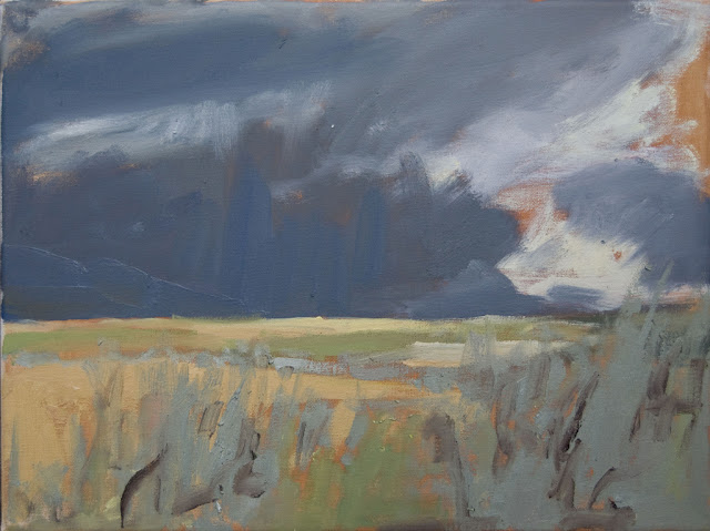
"Centennial Dust Storm" by the author, Centennial Mountains, Oil on Canvas 2010


Climbing to the sky in non-home landscapes: 


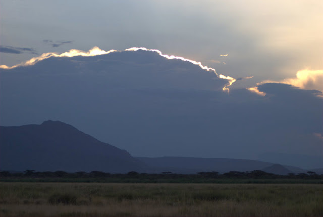
Light Horizon, by the author, Kenya 2007


Ugh, how gaudy.


23 November 2012

[notes from a landscape of Thanksgiving]


This is a landscape of Thanksgiving. A place where a tradition of annual community gathering around the harvest takes place. Even as a landscape architect and foodie, I didn't really grasp the meaning of the other half of Thanksgiving aside from cooking and chowing down: the collective harvest. A couple of weekends ago at two separate events around San Francisco, I took part in two such events: my cousin's cattle branding and friends' olive harvest. Friends and family gathered from around the state and country to help out in exchange for the chance to show off skills or a new horse; eat, drink, and be merry; and tell tall tales with good company. However, more than anything else, I now realize, they come to be a part of something that is much greater than any individual effort. They come to feel helpful, to feel a sense of purpose, and to feel a sense of belonging to a community of people who have shared a completely unique experience. 

Images of the harvest from George and Kit Lee of Mendocino County's Chatham Ranch


Persimmon tree (Diospyros spp.) famous for their gorgeous fall color and late fall crop. 

Not only was I inspired by the event, but I was equally impressed by the quality of their trees and the stewardship of both their land and of their crop. The difference in taste and health benefits between olives that are picked and processed by hand is undeniable. The final product: 


The second event was the annual cattle branding hosted by the Baldwins in Rio Vista, California. Although my preoccupation vaccinating some 200+ head of cattle distracted me from taking pictures of the branding itself, I did eek out a couple of sketches and images from the after party. I feel lucky to have been part of these and look forward to helping out at many future collective harvests. I hope you get to also.


14 November 2012

[notes on the image of a successful life]


My perspective of what life as a young creative professional looks like shifted this summer visiting friends in Topanga Canyon, in an off-the-radar kind of place north of L.A. 

The first friend was talented actress Missi Pyle (recently in "The Artist") who's bravely following her creative winds. The second two were Andrew Cushman, advocate at Tree People, kayak guide on the indomitable L.A. River, and lifelong adventurer and his girlfriend Giulia, gorgeous surfer and lawyer at the NRDC. Very different people doing very different things, yet bound together by this place, our current economic climate, and a commitment to living well in the most honest sense, pursuing passion, and contributing to our culture and environment. Regardless of the risks and rewards. Along with six other similarly successful squatters, Andrew and Giuilia "rent dirt" on a 25-acre communal spread. Their bricks and mortar include an Airstream trailer, a large deck with a canvas wall tent, and a vegetable garden. As I watched Giulia leave calmly for work after coffee overlooking the canyon and an hour of surfing in a well-pressed suit, I was reminded that it's time for a major overhaul of what the image of a successful life looks like today. Here's a glimpse into theirs:


Seeing this intentionally simple lifestyle while simultaneously facing massive student loans,  an ongoing recession, and a move to a new city, I took the chance to begin to craft what my own life could look like. 

While I never imagined that I'd be 32 and living in an Airstream trailer, I'm doing just that in the San Francisco Bay area. It comes with the job. I turned down standard salaried positions for the chance to work in an innovative design collective, designing healthy landscapes for people. BASE Landscape Architecture. Check them out. We work our creative magic from 9-6 with a refuel for lunch often at my colleagues' veggie garden around the corner. We encourage each other to maintain a life outside of work, to engage in the community, and to check our egos at the door. Our clients are visionary, value that we do things differently, and appreciate our fresh approach to their projects and our own practice. Life seems to happening on the terms of honest intent rather than expected pretense. I'm having a lot of fun, keeping my costs down which allows me the flexibility to pursue innovative new ideas and clients, painting when I can, and exploring the area. Come visit, the door's open.


BASE Landscape Hideout, Photo credit: Dwell Magazine, "The Airstream Life"

BASE Landscape Hideout workspace, Photo credit: Dwell Magazine, "The Airstream Life"


14 August 2012

A Landscape Architecture Practice on the Ground

Every landscape architect will tell you that his work is based on the ground. This summer I'm exploring what that means, how it translates to design, and how important it is to my own practice. I'm testing 5 projects at 5 sites over 5 months.

Today and for one more month I'm on 2 + 3 near Zion National Park in southwest Utah with Peter Stempel + Form Tomorrow, a visionary architect and his equally relevant non-profit.

 Landscape Architecture Desk  Landscape Architecture Desk  Landscape Architecture Desk
”Leeds Leeds Creek Trails Site Scouting Until the Soles Wear Out

The offices + sites of Form Tomorrow (1 trail, 1 river, and an evening desk)  


PROJECT 2 
Colorado River tributary watershed analysis + planning project (Virgin River)

Appropriately dubbed "Wade and Map", this project complements parallel regional efforts by governmental and non-governmental organizations to survey the Upper Virgin River. Ours lies in contrast to their work, however, in that theirs relies on aerial imagery and GIS and LIDAR mapping to understand ground and water, ours relies on some of the same yes, but mostly on observations from well, the ground and water. We started simply by walking down the Virgin River. 44 miles through Zion National Park to St George, Utah through 18 watersheds, 5 towns, deep canyons, and farmland. From pristine riverine corridors to rip rap ranch embankments and riverfront second homes, we inspected every bend and undercut bank, dodging flash flood warnings, electrified barbed wire, 105-degree desert days, and tubing European tourists most of the way. I'm pleased to report that it was fun, uncomfortable at times, and invaluably productive. Walking an entire stretch of river, in addition to GIS mapping and analysis over time, allowed us to really understanding how this river and all of its tiny parts work as a system. And more importantly, to translate this data into tools and images that any planner, conservationist, or citizen can use to make informed strategic planning and localized design decisions along this valuable river and its watersheds in the future.


Virgin River Case Studies in progress, S. Dabney


PROJECT 3
250 acre trail network on BLM, USFS + mining land (Leeds Creek. near St George UT)

This design project was kicked off not with a powerpoint presentation but with a brunch. Like many other projects, it was a reminder that working on the ground means working with people in the community. Not simply being introduced or presenting findings to them, but exchanging digits. Enjoying dinner with LoAnne and reading the articles she passes along; talking western US land politics over fried scones at Glen and Jane's; shooting the breeze with Glen at his Native American jewelry store; going to a sweat lodge with Glen's friend; going to boring and overly dramatic town hall meetings; getting a sense of the site through them and through their stories and guidance. It was one distinct morning though, pausing on a plant walk with Clarence--a Paiute elder--that the site became a place for me as I watched him watch generations of stories and sufferings, plant spirits and rock spirits, and the everything of that moment rise into the dawn as it stretched over this red cliff desert expanse.


Getting to know this place and where the trails would start, pass through, and end happened slowly. One full first day. A couple of early mornings. One late night with two rattlesnakes. An afternoon in a torrential downpour, yet most in 100-degree plus blazing sun on foot, on a bike, in 4-wheel-drive vehicles. Our team designed the trails with our bodies as much as with our minds, in the same ways that people who use the trails in the future will. It required countless false starts, two melted shoe soles, shoddy GPS apps, jumping off little cliffs, and surveillance-camera-trespassing. Most of all it required discarding lazy trust in or reliance on aerial maps or images to tell the whole truth. 


    ”Mapping                  Trail Design Problem Solving

We're wrapping up design of the trail system, vetting them with stakeholders including LoAnne and the community, the US Forest Service, Fish and Wildlife, and infamous Utah BLM (see the NYTimes article that came out last week) that has been a great advocate of our work and our process. Meaning the maps aren't published yet, but everyone involved--from the bureaucrats to the brunch bunch--has expressed collective interest in moving forward and ensuring the project moves forward at the same clip. Keep your eyes open for new BLM maps and trails in the Silver Reef and Red Cliffs area north of the St George mountain biking and hiking mecca for the results of our work.

After just 2 1/2 months of working on the ground, my ideas of my practice during this trial period are starting to shift beyond my 5-month horizon. Signing off for the night; Dale's stopping by early to take us on a ride in the back of his pickup to Babylon, the as-yet-unexplored-section of the area's future trail network.